Overview
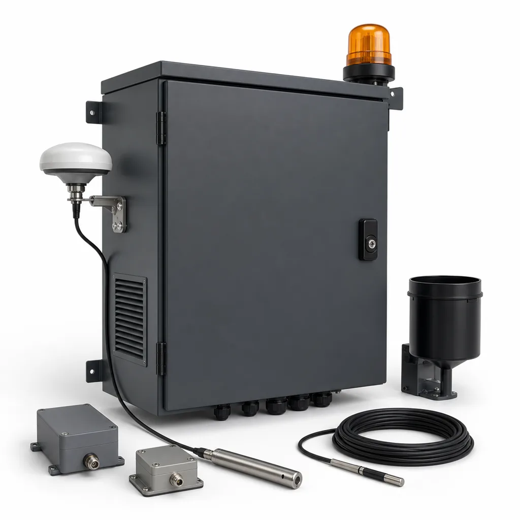
REDCOAST.LTD's RC-GEO-800 is a grid-powered, end-to-end geohazard monitoring and early-warning system that detects and forecasts slope instability — landslides, rockfalls, debris flows, embankment creep and ground subsidence — before it threatens roads, railways, hillside communities and critical infrastructure. It fuses high-precision surface and subsurface geotechnical instrumentation with a rugged edge early-warning controller, a web management platform and a mobile app, converting millimeter-scale ground movement, tilt and pore-water-pressure changes into graded, automatic alerts and physical warning actions. Built and delivered as one integrated hardware-and-software solution rather than a bag of third-party parts, it gives highway and railway authorities, dam and reservoir operators, open-pit mines and municipalities continuous 24/7 situational awareness — and, critically, the lead time to close a road, stop a train or evacuate a slope before failure occurs.
Key Features
- Multi-parameter sensor fusion on a single gateway: GNSS surface displacement, MEMS tiltmeters, crackmeters/extensometers, in-place inclinometers, vibrating-wire piezometers, rain gauges and channel geophones.
- Millimeter-class GNSS deformation monitoring (2.5 mm horizontal, 5 mm vertical) with continuous, unattended operation and automatic baseline computation.
- Edge early-warning engine running displacement-rate, acceleration ("jerk"), inverse-velocity failure forecasting and rainfall intensity–duration threshold models locally, so alerts fire even if the uplink is down.
- Graded three-level alarm logic (Attention / Warning / Alarm) mapped to an intuitive green–yellow–red traffic-light model.
- Automatic local actuation — ≥110 dB siren, red/amber LED beacon, variable-message-sign text and barrier-gate relay outputs — for a first response with no human in the loop.
- Rapid debris-flow and rockfall detection using geophone arrays that recognize the characteristic ground-vibration signature within seconds of an event entering the channel.
- Grid power with LiFePO4 UPS backup for uninterrupted operation through mains outages; a solar + battery configuration is available for genuinely remote sites without a grid connection.
- Custom REDCOAST signal-conditioning PCB reads vibrating-wire, 4–20 mA, voltage and digital RS-485 geotechnical sensors from all major instrument manufacturers, protecting existing investments.
- Open northbound integration via Modbus RTU/TCP, MQTT and HTTPS/REST to SCADA, ITS and third-party emergency command platforms.
- Cloud platform and iOS/Android app with live trends, configurable thresholds, event replay, audit logs and multi-channel SMS/email/push notifications.
Technical Architecture
The system is organized in four layers. At the sensing layer, a distributed field of instruments captures the physical precursors of slope failure: continuous GNSS receivers track absolute surface displacement to the millimeter; biaxial MEMS tiltmeters resolve angular rotation down to about 0.001°; crackmeters and multi-point extensometers measure surface and borehole strain; in-place inclinometers profile subsurface shear-zone movement; vibrating-wire piezometers report pore-water pressure — the single most important trigger for rainfall-induced failure; and tipping-bucket rain gauges quantify the driving rainfall. In debris-flow channels, linear geophone arrays add fast seismic event detection.
At the edge layer, REDCOAST's custom acquisition and control PCB conditions and digitizes every sensor type. A sweep-excitation vibrating-wire front end measures resonant frequency (400–6000 Hz) with an integrated thermistor channel for temperature compensation, while a 24-bit analog front end and an RS-485 Modbus bus ingest analog and digital instruments. The edge controller time-stamps data (GNSS/NTP synchronized), stores it locally, and runs the early-warning algorithms on-device: it computes deformation velocity and acceleration, applies the inverse-velocity method to project a probable time-of-failure, and compares rainfall against site-calibrated intensity–duration curves. When thresholds are crossed, the controller drives the local warning outputs directly — this local autonomy is what allows a response in seconds even when the network is unavailable.
At the communication and cloud layer, the gateway forwards data over 4G/5G or Ethernet to the REDCOAST platform, which stores long-term history, renders live trends and cross-sensor correlations, manages thresholds and user roles, replays events and dispatches notifications. Field sensor nodes reach the gateway over LoRa or NB-IoT for low-power, long-range links, or over wired RS-485 where cabling is practical. The whole chain is designed so that local response, network telemetry and cloud analytics reinforce one another rather than any single point being a hard dependency.
Connectivity & Power
Uplink is via redundant 4G/5G LTE and Gigabit Ethernet; the field sensor network uses LoRa, NB-IoT or RS-485 Modbus depending on span and power budget. Northbound protocols include MQTT, Modbus RTU/TCP and HTTPS/REST for SCADA and command-center integration, with GNSS/NTP time synchronization. Because the RC-GEO-800 is designed first for grid-connected sites — highway and railway cut slopes, urban hillside developments, dam abutments and mine benches that have wayside power — the standard power input is AC 100–240 V, 50/60 Hz, backed by an internal LiFePO4 UPS that sustains 48–72 hours of full operation through an outage. For genuinely off-grid locations, an optional 100–200 Wp solar array with a 12.8 V LiFePO4 bank and MPPT controller is available; the choice is made per site, not defaulted onto every unit.
Protection & Reliability
The edge cabinet is rated IP66 and field sensor enclosures IP67/IP68 for permanent outdoor and buried service. The electronics operate from -40 °C to +70 °C and tolerate 0–100% condensing humidity, salt fog, dust and UV — matching alpine, coastal, desert and tropical deployments alike. Multi-stage surge protection on power and signal lines (Class II, 20 kA) plus IEC 62305-aligned lightning protection guard the exposed instrumentation on ridgelines and towers. Redundant local storage, watchdog-supervised firmware, dual-SIM failover and UPS hold-up together target unattended, fail-operational service in harsh terrain, backed by a 2–5 year warranty.
Application Scenarios
- Highway & expressway cut slopes: continuous watch over unstable rock cuts and fill embankments above carriageways, auto-triggering roadside VMS and barrier gates when movement accelerates.
- Railway embankments & cuttings: early warning of track-side slope failure and debris intrusion, interfacing with signaling to protect trains and passengers.
- Dams, reservoirs & tailings storage: pore-pressure and deformation monitoring of embankment dams and tailings facilities for continuous safety compliance.
- Urban hillside communities: protecting homes and access roads below steep terrain during monsoon and typhoon seasons with public siren and app alerts.
- Open-pit mines & quarries: bench and highwall stability monitoring with inverse-velocity failure prediction to safeguard personnel and equipment.
- Debris-flow gullies & alluvial fans: geophone-based channel detection giving downstream settlements and roads seconds-to-minutes of warning.
Case-style Examples
- Mountain expressway slope-protection retrofit: A landslide-prone rock cut above a two-lane expressway was instrumented with GNSS monitors, tiltmeters, a vibrating-wire piezometer array and a rain gauge, all feeding one grid-powered edge gateway with UPS. Site-calibrated rainfall thresholds and a 1 mm/min velocity trigger drove a roadside VMS and flashing beacon; during an intense storm the system escalated to Alarm and automatically displayed a road-closure message before visible movement reached the pavement.
- Reservoir-abutment dam-safety deployment: For an embankment dam, piezometers and in-place inclinometers were tied into the platform for regulatory safety reporting, with the mobile app giving the operator live pore-pressure trends and threshold breaches — replacing manual quarterly readings with continuous, auditable monitoring.
- Debris-flow channel protection for a hillside village: A linear geophone array across a torrent channel, paired with an upstream rain gauge, detects debris-flow onset and sounds a ≥110 dB siren at the village and lowers a barrier at the access road within seconds, buying precious evacuation time.
Customization & Selection Guide
Start from the hazard type: creep/landslide sites prioritize GNSS + tilt + inclinometer + piezometer; rockfall and debris-flow sites prioritize geophone arrays with fast siren/barrier actuation; dam and tailings sites emphasize piezometer and inclinometer arrays for compliance. Choose the power class next — grid + UPS for powered corridors, solar + LiFePO4 for remote peaks. Select the field link by span and density (RS-485 for compact clusters, LoRa/NB-IoT for dispersed nodes over kilometers). Finally scale the warning package — from platform/app/SMS only, up to full local siren + beacon + VMS + barrier-gate control tied into existing ITS or SCADA. REDCOAST tunes channel counts, sensor mix, thresholds and enclosure format to the site rather than forcing a fixed SKU.
Deployment & After-sales
Instruments are installed in boreholes, on slope faces and in channels per a site survey; the edge cabinet mounts on a pole or wall with grid and comms brought in. REDCOAST provides commissioning support, threshold calibration assistance, platform onboarding and operator training. Ongoing support covers remote diagnostics, firmware updates, spare-part supply and SLA-based maintenance. Because the hardware is developed in-house, board-level revisions and sensor-interface additions can be turned around quickly for project-specific requirements, keeping delivery timelines tight.
Standards & Compliance
The system is engineered in line with the ISO 18674 series for geotechnical instrumentation (displacement, inclinometer and piezometer measurement), with EMC and immunity to IEC 61000-4, lightning protection to IEC 62305, and CE / RoHS conformity. Enclosure ingress protection is verified to IEC 60529 (IP66/IP67/IP68). Warning-device outputs and alert wording can be configured to match local road-authority and civil-protection alerting conventions.
Why REDCOAST.LTD
REDCOAST.LTD delivers the complete geohazard early-warning solution — sensors, custom signal-conditioning and controller PCBs, warning devices, platform and app — integrated by one team. Because we design and open our own PCBs, we can read virtually any geotechnical instrument, add channels or interfaces on demand, and adapt firmware and thresholds to each slope, dam or channel. That end-to-end software-and-hardware control means a monitoring network tailored to your actual risk, standards and budget — not a compromise assembled from incompatible off-the-shelf boxes.
Protect your roads, railways, dams and communities with a monitoring and early-warning system built around your site. Contact REDCOAST.LTD for a custom geohazard monitoring proposal.
Specifications
Sensing & Instrumentation
- GNSS Surface Displacement
- 2.5 mm + 1 ppm (H), 5 mm + 1 ppm (V)
- MEMS Tiltmeter Range / Resolution
- ±15° / 0.001°
- Vibrating-Wire Interface
- 400–6000 Hz, 0.1 Hz res., with thermistor temp channel
- Crackmeter / Extensometer
- 0–100 / 0–250, res. 0.01 mm
- VW Piezometer (Pore Pressure)
- 0–1 / 0–5 / 0–10, ±0.1% FS bar
- Rain Gauge (Tipping Bucket)
- 0.2 mm/tip
- Channel Geophone (Debris Flow)
- 4.5–315 Hz
Edge Warning Controller
- Sensor Channels
- up to 8 VW / 16 analog / 64 digital (RS-485)
- Sampling Interval
- 1 s – 24 h configurable
- High-Rate Vibration Sampling
- up to 2 kHz
- Warning Algorithms
- velocity, acceleration, inverse-velocity, rainfall I–D threshold
- Alarm Levels
- 3 (Attention / Warning / Alarm)
- Local Data Storage
- 32 GB
- Local Alert Latency
- < 3 s
Warning & Actuation
- Siren SPL
- ≥ 110 dB @1m
- Warning Beacon
- Red/Amber LED, flashing
- Relay Outputs (VMS / Barrier)
- 6 × dry contact, 5 A
- Notification Channels
- SMS, App push, Email, Platform
- Notification Latency
- < 10 s
Connectivity
- Uplink
- 4G/5G LTE, Gigabit Ethernet
- Field Sensor Network
- LoRa, NB-IoT, RS-485 Modbus
- GNSS Constellations
- GPS, GLONASS, Galileo, BeiDou
- Protocols
- MQTT, Modbus RTU/TCP, HTTPS/REST
- Time Synchronization
- GNSS / NTP
Power (Grid)
- Input Voltage
- AC 100–240 V
- Line Frequency
- 50/60 Hz
- System Power Consumption
- 15–40 W
- UPS Backup (LiFePO4)
- 48–72 h autonomy
- Surge Protection
- Class II, 20 kA (power & signal)
- Solar Option (remote sites)
- 100–200 Wp PV + 12.8 V LiFePO4 + MPPT
Protection & Environment
- Cabinet Ingress Protection
- IP66
- Field Sensor Protection
- IP67 / IP68
- Operating Temperature
- -40 to +70 °C
- Relative Humidity
- 0–100 (condensing) %
- Lightning / EMC
- IEC 62305 / IEC 61000-4
Physical & Compliance
- Edge Cabinet (H×W×D)
- 600×400×250 mm
- Cabinet Material / Finish
- Powder-coated steel / aluminum
- Sensor Node Enclosure
- Cast aluminum / stainless steel
- Standards
- ISO 18674, IEC 60529, CE, RoHS
- Warranty
- 2–5 years
Capabilities — configurable per project
Specifications are tailored to each project — the options below show what we can support.
Power
- Grid + LiFePO4 UPS
- Solar + LiFePO4 (remote sites)
- Wind-solar hybrid
Sensing Package
- Surface (GNSS/tilt/crack)
- Subsurface (inclinometer/piezometer)
- Channel (geophone/debris-flow)
- Rainfall & environment
Connectivity
- 4G/5G
- NB-IoT
- LoRa
- Fiber/Ethernet
Warning Output
- Siren + beacon
- VMS / barrier gate
- SMS / app / platform
- SCADA / third-party
Deployment
- Highway/railway cut slope
- Urban hillside
- Dam / reservoir / tailings
- Open-pit mine
Related solution guidance
Traffic Safety Checklist
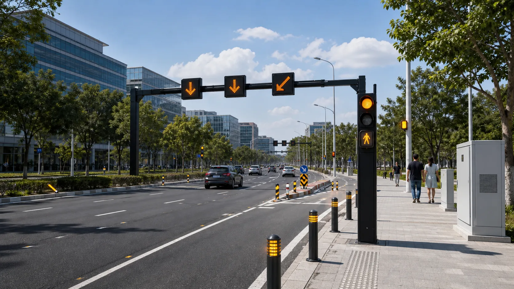
Deployment checklist for connected traffic warning signs, beacons, road guidance devices, power, visibility, monitoring and acceptance tests.
Traffic Safety
Plan connected traffic safety systems with warning beacons, LED signs, road guidance devices, sensing, control cabinets and monitoring software.
Ports and Logistics
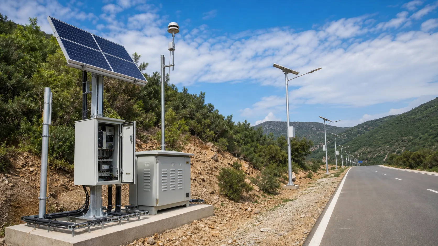
Outdoor IoT infrastructure for ports, yards and logistics areas: lighting, guidance, safety, solar power, monitoring and maintenance visibility.
Frequently Asked Questions
What geohazards can the RC-GEO-800 monitor?
It monitors rainfall-induced and creep landslides, rockfalls, debris flows, slope and embankment deformation, ground subsidence, and dam/tailings movement. A single edge gateway fuses GNSS, tiltmeters, inclinometers, crackmeters, piezometers, rain gauges and geophones for a full hazard picture.
How does the system predict a slope failure before it happens?
It runs early-warning algorithms locally on the edge controller: deformation velocity and acceleration trends, the inverse-velocity method to project a probable time-of-failure, and site-calibrated rainfall intensity–duration thresholds. Alerts escalate through three graded levels (Attention, Warning, Alarm) on a green–yellow–red model.
How accurate is the displacement measurement?
Continuous GNSS resolves surface displacement to about 2.5 mm horizontally and 5 mm vertically, MEMS tiltmeters resolve roughly 0.001° of rotation, and vibrating-wire sensors read pore pressure and strain to 0.1% of full scale — enough to catch the millimeter-scale precursors of failure.
Does it need grid power and internet to work?
The standard configuration runs on AC 100–240 V mains with a LiFePO4 UPS giving 48–72 hours of backup, suited to highways, railways, dams and urban hillsides. A solar + battery option covers off-grid sites. Warning logic runs locally, so sirens, beacons and barriers still fire even if the 4G/5G or Ethernet uplink is temporarily down.
How fast is the alert when an event occurs?
Local siren, beacon, VMS and barrier outputs trigger in under 3 seconds once a threshold is crossed, and remote SMS/app/platform notifications follow within about 10 seconds. Geophone-based debris-flow detection recognizes a flow entering the channel within seconds of arrival.
Can it integrate with existing geotechnical sensors and SCADA?
Yes. The custom REDCOAST.LTD signal-conditioning PCB reads vibrating-wire, 4–20 mA, voltage and RS-485 digital instruments from all major manufacturers, and the platform exposes Modbus RTU/TCP, MQTT and HTTPS/REST plus dry-contact outputs to connect with SCADA, ITS and emergency command systems.
What standards and certifications does the system meet?
It is engineered in line with the ISO 18674 series for geotechnical instrumentation, with EMC to IEC 61000-4, lightning protection to IEC 62305, ingress protection verified to IEC 60529 (IP66/IP67/IP68), and CE / RoHS conformity.
Is REDCOAST.LTD just a reseller, or does it build the hardware?
REDCOAST.LTD delivers the complete solution in-house — custom signal-conditioning and controller PCBs, warning devices, the web platform and the mobile app — integrated by one team. Because we design our own boards, we can add sensor channels and interfaces and tune firmware and thresholds to each specific site.