Overview
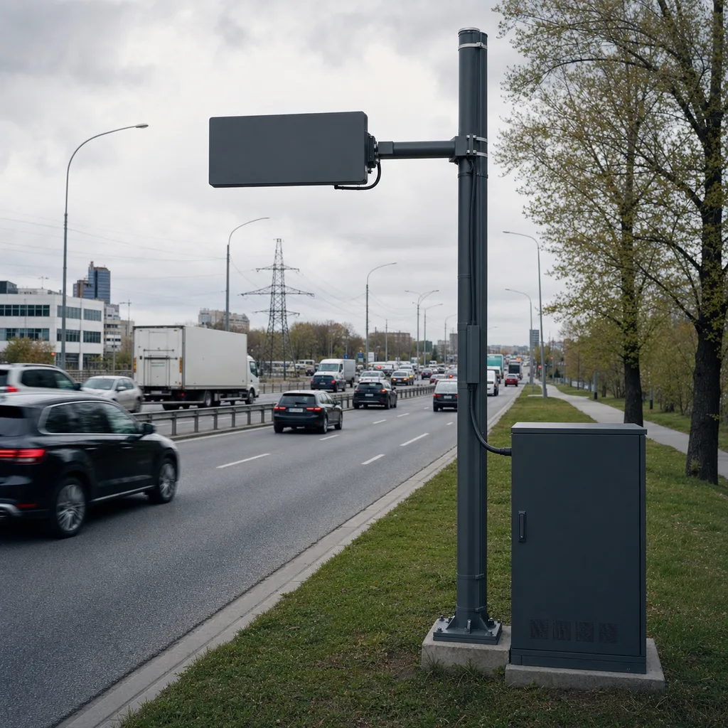
The REDCOAST.LTD RC-TMS-700 is a permanent, non-intrusive traffic monitoring and vehicle classification station built for road authorities, toll operators, city traffic departments and transport-planning consultants that need continuous, reliable traffic data without cutting the pavement or closing lanes. A single station mounts at the side of the road and uses dual-beam side-fire radar to measure per-vehicle volume, speed, occupancy, gap, headway and length-based class across every lane in both directions, 24 hours a day, in all weather. The result is trustworthy Average Annual Daily Traffic (AADT), directional and classification data that feeds pavement design, capacity planning, tolling audits and smart-corridor operations — delivered through an open, standards-based interface and a self-hosted or cloud platform.
Key Features
- Non-intrusive dual-beam side-fire radar covering up to 12 discrete lanes bidirectionally, installed in hours with no lane closure and no trenching.
- Per-vehicle metrics: volume, average and 85th-percentile speed, occupancy, gap, headway, vehicle length and length-based classification bins.
- Optional intrusive add-on (inductive loops or piezo/quartz axle strips) for full axle-based FHWA 13-class (Scheme F) and WIM-lite classification where regulations require axle data.
- On-board edge-AI processor performs classification locally and buffers 12+ months of aggregated bins, so data is never lost during a comms outage.
- Continuous automatic-traffic-recorder (ATR) operation, engineered for rain, fog, snow, dust and full darkness with no dependence on ambient light.
- Open data interface: NTCIP 1206, MODBUS TCP, REST/JSON and MQTT, plus SNMP health telemetry, for painless integration with existing ATMS/central systems.
- Self-developed multi-channel radar signal-conditioning board and power-management PCB — the reason REDCOAST.LTD can tune detection, add sensor channels and adapt the station per project.
- Mains-powered with a LiFePO4 UPS for 24–72 h ride-through; solar or wind-solar option for sites without a grid connection.
- Remote OTA firmware, remote re-calibration, GPS/PTP/NTP time sync and tamper/enclosure-open alarms for low-touch fleet operation.
- Web management platform plus mobile app: live per-lane dashboards, historical reports, class distribution, speed profiles and one-click data export (CSV/JSON/TMG-style formats).
Technical Architecture
Each RC-TMS-700 station is organised around four subsystems. The detection head is a low-power FMCW side-fire radar (24 GHz for cost-efficient counting or 77 GHz UHD/4D for higher lane resolution and better wet-weather stability) that forms a virtual speed-trap over each lane. Raw radar returns are digitised and cleaned by REDCOAST.LTD's own multi-channel signal-conditioning board, which also accepts the optional inductive-loop and piezo axle inputs. An edge controller — a quad-core ARM SoC with a neural accelerator — runs the tracking and classification models, aggregates data into user-defined bins (from 20-second to 60-minute intervals) and writes to an industrial local database. A power-management and communications module handles grid/UPS/solar input, surge protection, and the cellular, fibre or Ethernet backhaul.
Data flow is edge-first: the station classifies and stores every vehicle locally, then pushes aggregated bins and health data to the central platform, so bandwidth stays low and a network dropout only delays — never deletes — data. On the platform side, REDCOAST.LTD's web software and mobile app provide fleet status, per-station reports and standards-compliant exports, and can forward records to a customer's central traffic-management system over NTCIP.
Connectivity & Power
For backhaul, the station supports 4G LTE and 5G NR cellular, 10/100/1000 wired Ethernet and fibre (SFP) for instrumented corridors, and NB-IoT or LoRa for auxiliary roadside sensors. Protocol support covers NTCIP 1206, MQTT, MODBUS TCP and SNMP. Power is scenario-driven: on urban arterials, tolling gantries, bridges, tunnels and any site with grid access the station runs on AC 100–240 V mains backed by a LiFePO4 UPS that rides through 24–72 hours of outage; only for genuinely remote, off-grid highway or rural count sites do we specify a solar or wind-solar package sized to local irradiance. Because supply is a configuration and not a fixed part of the product, the same station serves a downtown intersection and a remote interurban corridor.
Protection & Reliability
The radar head is sealed to IP67 and the roadside enclosure to IP55/IP66, with conformal-coated boards, wide-range -40 to +75 °C operation and 5–100 % RH tolerance for salt-fog coastal, high-dust desert and freezing alpine environments. Multi-stage surge protection (up to 10 kA, IEC 61643) guards the mains, signal and comms lines against lightning and switching transients. With no moving parts and solid-state detection, designed MTBF exceeds 60,000 hours and service life is 8–10 years; remote diagnostics, self-test and auto-calibration keep field visits rare. Stations ship pre-calibrated with lane-mapping documentation for fast, repeatable commissioning.
Application Scenarios
- Urban arterial & intersection counts: permanent volume, speed and directional data for signal timing, congestion management and city planning without disrupting traffic.
- Highway mainline AADT stations: continuous automatic-traffic-recorder sites feeding annual traffic statistics, growth-trend analysis and highway asset management.
- Freight & classification corridors: length- or axle-based classification to size pavement, plan freight routes and audit heavy-vehicle flows.
- Toll & managed-lane corroboration: independent volume and classification data alongside tolling gantries for revenue assurance and audit.
- Bridge, tunnel & work-zone monitoring: compact side-fire mounting where in-road loops are impractical, giving live throughput and speed during operations or construction.
- Smart-corridor & sustainability programmes: feeding real-time flow and speed into ATMS, travel-time and low-emission-zone analytics.
Case-style Examples
- Metropolitan arterial count programme (by scenario): a city traffic department replaced dozens of manual tube counts with a network of RC-TMS-700 stations on existing signal poles, gaining year-round per-lane volume, speed and class data while cutting field crews and lane closures dramatically.
- Interurban highway ATR network: a road authority deployed grid-powered stations at permanent count locations along a trunk route, with solar variants at two remote gaps, all reporting AADT and 13-class data into the central traffic-monitoring system over NTCIP.
- Freight-route pavement study: a planning consultant used the piezo axle option to capture full FHWA 13-class and axle-load profiles on a haul corridor, informing pavement rehabilitation design and overload-trend analysis.
Customization & Selection Guide
Choose the radar frequency by need: 24 GHz for budget-sensitive counting on narrower cross-sections, or 77 GHz UHD/4D where you need finer per-lane resolution, more classification bins and best rain performance on wide, multi-lane roads. Add the inductive-loop or piezo module only if your programme mandates axle-based FHWA 13-class or WIM-lite; pure statistics and planning are well served by non-intrusive length classes alone. Pick power by site — grid + UPS for connected locations, solar/wind-solar for off-grid. Match backhaul to the corridor (fibre/Ethernet where conduit exists, 4G/5G otherwise). Cabinet size and mounting (roadside pole, existing streetlight/signal pole, cantilever mast or overhead gantry) are selected from deployment geometry. REDCOAST.LTD will help spec mounting height, offset and lane mapping for your cross-section.
Deployment & After-sales
Side-fire stations mount 5–9 m high with a lateral offset set to the number of lanes; installation needs only pole access, not lane closure or pavement cutting, so a site is typically live the same day. Each unit ships pre-configured and pre-calibrated with a lane-mapping diagram, device IDs and a calibration record. REDCOAST.LTD provides remote commissioning support, OTA updates, a 2–3 year warranty, spare-parts supply and platform/API onboarding, with optional extended maintenance and calibration contracts. Typical project lead time is confirmed per order based on quantity and configuration.
Standards & Compliance
Designed to align with NTCIP 1206 (data collection and monitoring device objects) and the FHWA Traffic Monitoring Guide 13-class scheme for data and classification, with the radar band per ETSI EN 302 264 / EN 300 440 or FCC Part 15 as applicable. Hardware targets CE and RoHS, IP67 (radar) / IP55–IP66 (enclosure) per IEC 60529, IEC 61643 surge protection and EN/IEC 61000 EMC. Axle/WIM options can be referenced to ASTM E1318 practice where weight data is collected.
Why REDCOAST.LTD
REDCOAST.LTD is an end-to-end smart-IoT solution provider: we deliver hardware, the web management platform and the mobile app as one integrated system, built and supported by a single team. Crucially, we design our own PCBs and board-level hardware in-house — the radar signal-conditioning board, the multi-channel acquisition front-end and the power-management board are ours — so we can add sensor channels, tune detection for your cross-section, integrate the exact NTCIP objects your central system expects and adapt the station to each project instead of forcing you into a fixed box. Hardware, firmware, platform and app move together, which keeps the whole solution controllable and deeply customizable.
Contact REDCOAST.LTD to scope a permanent traffic monitoring and classification deployment tailored to your corridors, lane counts, power situation and central-system integration.
Specifications
Radar Detection
- Technology
- Dual-beam side-fire FMCW radar
- Frequency Band
- 24 or 77 GHz
- Detection Range
- 3-75 m
- Lanes Covered
- up to 12 (bidirectional)
- Speed Range
- 5-250 km/h
- Speed Accuracy
- ±3 km/h
- Volume Accuracy
- 95-98 %
- Length Classification Bins
- up to 8 (configurable)
Edge Processing & Data
- Processor
- Quad-core ARM SoC + NPU
- Local Storage
- 32-256 GB
- On-board Data Retention
- >=12 months (binned)
- Aggregation Interval
- 20 s - 60 min (configurable)
- Reported Metrics
- Volume, speed (avg/85th), occupancy, gap, headway, class
- Time Synchronization
- GPS / PTP / NTP
- Data Outputs
- NTCIP 1206, MODBUS TCP, REST/JSON, MQTT
Optional Intrusive Sensing (axle-based)
- Inductive Loops
- 2-6 per station
- Axle Sensors
- Piezo / quartz strips
- Axle Classification
- FHWA 13-class (Scheme F)
- Mode
- WIM-lite (axle count / spacing / load estimate)
Connectivity
- Cellular
- 4G LTE / 5G NR
- Wired
- 10/100/1000 Ethernet, fibre SFP
- IoT (aux sensors)
- NB-IoT, LoRa
- Protocols
- NTCIP, MQTT, MODBUS, SNMP
Power (grid example)
- Input Voltage
- AC 100-240 V
- Mains Frequency
- 50/60 Hz
- Power Consumption
- 15-45 W
- Backup
- LiFePO4 UPS, 24-72 h ride-through
- Surge Protection
- up to 10 (IEC 61643) kA
Mechanical & Environmental
- Radar Ingress Protection
- IP67
- Enclosure Ingress Protection
- IP55-IP66
- Operating Temperature
- -40 to +75 °C
- Relative Humidity
- 5-100 %RH
- Mounting Height
- 5-9 m
- Housing Finish
- Powder-coated aluminium / steel
Reliability
- MTBF
- >60,000 h
- Design Life
- 8-10 years
- Warranty
- 2-3 years
- Calibration
- Factory pre-calibrated, remote re-calibration
Capabilities — configurable per project
Specifications are tailored to each project — the options below show what we can support.
Detection Technology
- Side-fire radar (24 GHz)
- Side-fire radar (77 GHz UHD/4D)
- Radar + inductive loop hybrid
- Radar + piezo axle (WIM-lite)
Power
- Grid AC + LiFePO4 UPS
- Solar off-grid
- Wind-solar hybrid
Connectivity
- 4G/5G
- Wired Ethernet / Fibre
- NB-IoT
- LoRa
Mounting
- Roadside pole
- Existing streetlight / signal pole
- Cantilever mast
- Overhead gantry
Data Platform
- REDCOAST cloud SaaS
- On-premise server
- Central-system integration (NTCIP)
Related solution guidance

Environmental Monitoring
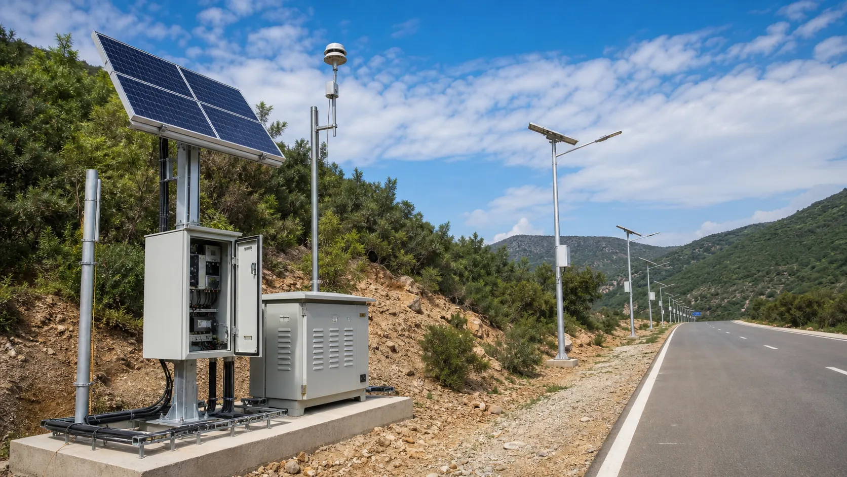
Deploy environmental monitoring stations with sensors, solar power, gateways, dashboards, alarms and data integration for city and industrial sites.

Municipalities
Municipal smart city programs for lighting, traffic safety, parking, smart poles and environmental monitoring with one hardware and software partner.
Ports and Logistics
Outdoor IoT infrastructure for ports, yards and logistics areas: lighting, guidance, safety, solar power, monitoring and maintenance visibility.
Frequently Asked Questions
What is a non-intrusive traffic monitoring station and how does it differ from in-road loops?
It is a roadside station that uses side-fire radar mounted beside the road to measure traffic, instead of loops or sensors cut into the pavement. The RC-TMS-700 needs no trenching or lane closure to install, works across all lanes at once, and has no in-road parts to wear out or fail under heavy trucks.
How many lanes can one RC-TMS-700 station monitor?
A single station monitors up to 12 discrete lanes in both directions from one side-fire radar head. Coverage depends on mounting height, offset and cross-section, and REDCOAST.LTD helps set the geometry during design so every lane is reported separately.
Can it classify vehicles by the FHWA 13-class (axle) scheme?
The radar provides length-based classification bins out of the box, which suits most volume and planning programmes. Where axle-based FHWA 13-class (Scheme F) or WIM-lite data is required, an optional inductive-loop or piezo axle module is added to capture axle count and spacing.
Is the station grid-powered or solar-powered?
Power is chosen by site. At urban, tolled, bridge and other grid-connected locations it runs on AC 100–240 V mains with a LiFePO4 UPS for 24–72 hours of backup. For genuinely off-grid highway or rural count sites, a solar or wind-solar package sized to local sunlight is available.
What data outputs and standards does it support?
It is designed to align with NTCIP 1206 for data-collection devices and the FHWA Traffic Monitoring Guide 13-class scheme, and it also exports over MODBUS TCP, REST/JSON and MQTT. Health and status are available via SNMP, so it integrates with existing ATMS and central traffic systems.
What accuracy can I expect for volume and speed?
Typical volume accuracy is 95–98% per lane and speed accuracy is about ±3 km/h under normal conditions. Actual performance depends on correct mounting height, offset and calibration, which is why every unit ships pre-calibrated with a lane-mapping diagram.
Does it work at night and in rain, fog or snow?
Yes. Radar detection does not rely on ambient light, so it works in full darkness, and it is engineered for rain, fog, snow and dust. The 77 GHz option offers the most stable performance on wide cross-sections in heavy precipitation.
How is it installed and does it need lane closures?
It mounts on a roadside pole, an existing streetlight/signal pole, a cantilever mast or a gantry, typically 5–9 m high. Because it is side-fire and non-intrusive, installation needs only pole access — no pavement cutting and no lane closure — and a site is usually live the same day.