Overview
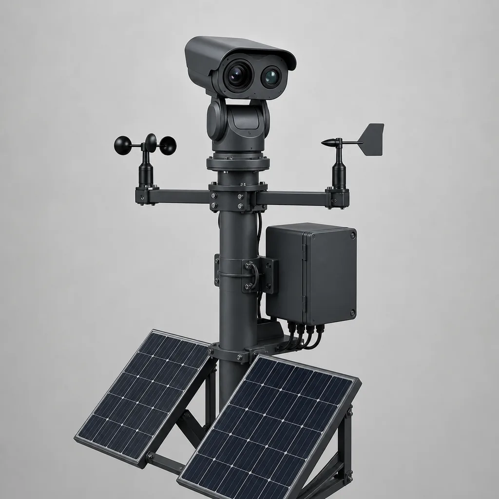
The REDCOAST.LTD RC-WFD-900 AI Wildfire Early Detection Tower is an end-to-end, ridgeline-to-command-center solution for catching wildland fires in their first minutes. It pairs a continuously scanning dual-spectrum (visible + thermal) camera head with on-tower edge AI, self-designed off-grid power, and a cloud GIS platform that pinpoints, verifies, and dispatches. Forestry agencies, national parks, water and power utilities, plantation and timber operators, and wildland-urban interface communities use it to shrink the gap between ignition and first response — the single factor that most determines whether a fire is a spot fire or a catastrophe. REDCOAST.LTD delivers the hardware, platform, and app as one integrated package, and because we design our own boards (MPPT power management, weather-sensor signal conditioning, and the edge-AI carrier), the whole system is tuned as a unit rather than bolted together from black boxes.
Key Features
- Dual-spectrum detection: a 4 MP visible camera for daytime smoke plumes plus an uncooled thermal imager for night-time flame and hotspot detection, so coverage is 24/7.
- Continuous 360° panoramic scanning: a servo pan-tilt head sweeps the full horizon every 60–120 seconds, giving one tower the reach of dozens of fixed cameras.
- Edge-AI smoke and hotspot recognition: on-tower neural inference flags smoke and heat signatures in seconds and only escalates candidate events, saving bandwidth on constrained links.
- Multi-tower triangulation: when two or more towers see the same plume, the platform computes GPS coordinates of the fire — not just a bearing.
- Long detection range: smoke visible up to ~20 km by day; thermal flame/hotspot up to ~8 km at night, terrain and weather permitting.
- Integrated fire-weather sensing: on-board wind, temperature, humidity, and pressure feed live Fire Weather Index / FFDI computation for risk-aware alerting.
- True off-grid autonomy: solar (or wind-solar hybrid) with LiFePO4 storage and 5–10 days of no-sun reserve for remote ridgelines with no utility power.
- Human-in-the-loop verification: a cloud + operator confirmation workflow suppresses false alarms from dust, cloud shadow, and industrial plumes.
- Open integration: ONVIF/RTSP video, MQTT/HTTPS telemetry, and CAP alerting connect to existing VMS, dispatch, and satellite feeds.
Technical Architecture
At the top of the mast sits the sensor head: a dual-spectrum PTZ assembly combining a 45x-zoom visible camera and an uncooled thermal core on a precision servo pan-tilt mechanism. The head runs a slow, continuous 360° sweep, capturing overlapping frames that the on-tower edge-AI unit stitches and analyzes in real time. Two model families run in parallel — a daytime smoke-plume detector working on the visible stream and a thermal hotspot detector working on the infrared stream — so the system does not go blind after dark. When either model raises a candidate, the head auto-centers and zooms on the target to grab confirmation imagery and a precise bearing.
Detections, bearings, and low-bitrate imagery are pushed to the REDCOAST.LTD cloud GIS platform, where events from neighboring towers are correlated. Two independent bearings on the same fire yield a triangulated GPS fix; a single bearing yields a line-of-sight sector overlaid on terrain and fuel maps. Operators review flagged events in a web console or the mobile app, confirm or dismiss, and trigger CAP-formatted alerts to dispatch, SMS/email/push recipients, and integrated command systems. Locally, a self-designed weather signal-conditioning board digitizes the wind/temperature/humidity/pressure sensors and computes a fire-danger index on-site, so risk context travels with every alert. Power and charging are governed by a self-designed MPPT board and battery-management logic that keep the camera, edge AI, and radios alive through multi-day overcast — the difference between a tower that watches every day and one that dies in the first storm.
Connectivity & Power
Because early-detection towers live on remote ridgelines, mountaintops, and firebreak high points where there is rarely grid power or fiber, the RC-WFD-900 is built off-grid first. A solar array (400–1000 Wp) charges a 48 V LiFePO4 bank (10–20 kWh) through the self-designed MPPT controller, delivering 5–10 days of autonomy with no sun; for high-latitude or heavily forested sites with weak winter sun, a wind-solar hybrid option adds a small turbine to carry the dark months. Where a nearby structure offers utility power, the same electronics run on grid with battery backup. Backhaul is chosen per site: 4G LTE / 5G where cellular reaches, licensed or 5 GHz point-to-point microwave to relay from tower to tower, and a satellite uplink option for truly isolated peaks. A low-power LoRa channel can carry compact alerts even when the video link is down, so a detection is never trapped on the tower.
Protection & Reliability
Every enclosure and the camera head are rated IP66/IP67 against driving rain, dust, and wind-blown ash, and the system operates from -40 °C to +70 °C to cover alpine winters and desert-margin summers alike. Steel masts and brackets are hot-dip galvanized and finished with a UV-stable powder coat for decades of outdoor life; guyed or lattice configurations survive wind gusts up to 60 m/s. Multi-stage surge protection and an IEC 62305 lightning system shield the electronics on exposed high ground, and the pan-tilt mechanism is designed for maintenance-free long-term rotation. Solar and battery sizing includes headroom for a thermostatically controlled heater that keeps optics clear in freezing fog, so detection performance holds through the seasons when fire risk is highest.
Application Scenarios
- Forest and national park protection: ridgeline towers watch large tracts of woodland, catching smoke long before a lookout or an emergency call and cutting response time from hours to minutes.
- Wildland-urban interface (WUI): towers on hills above towns and subdivisions give communities and fire services early warning where homes meet fuel.
- Power utility corridors: utilities mount detection along transmission and distribution lines to catch both ignitions their assets might cause and fires that threaten the grid, supporting fast de-energization decisions.
- Plantation, timber, and grassland estates: commercial forestry and rangeland operators protect high-value standing timber and pasture across areas too large to patrol.
- Watershed and reservoir catchments: agencies protect water-supply catchments where post-fire erosion and ash would foul reservoirs.
- Industrial and infrastructure buffers: mines, solar farms, LNG sites, and rail corridors monitor surrounding vegetation for encroaching fire.
Case-style Examples
- Ridgeline network over managed forest: A forestry authority deployed a chain of RC-WFD-900 towers along a range of firebreak peaks, each solar-powered with microwave links relaying to a valley gateway. Overlapping fields of view let the platform triangulate GPS coordinates for any smoke seen by two towers, and dispatch received map-located alerts with confirmation imagery, replacing seasonal human lookouts.
- Off-grid powerline corridor: A utility protecting a long, remote distribution corridor chose the wind-solar hybrid configuration and 30 m masts to clear the tree canopy, with satellite backhaul on the most isolated spans. The system flagged an ignition within minutes of a line fault, giving operators time to de-energize and roll crews.
- Wildland-urban interface above a resort town: Towers on the slopes overlooking a mountain community ran the thermal detector through the night and pushed CAP alerts into the regional emergency system, giving residents earlier evacuation lead time during peak fire season.
Customization & Selection Guide
Start with the thermal core: the 640×512 uncooled option suits most forest and WUI sites, 1280×1024 extends range and detail, and a cooled MWIR core is available for the longest-range grassland and desert-margin coverage. Choose the mast by canopy and terrain — 10–15 m for open ridges, 20–30 m to see over tall timber, or a bracket kit to reuse existing towers and rooftops. Size power to your worst month: baseline solar for sunny climates, larger arrays or the wind-solar hybrid for high-latitude winters. Pick backhaul by what reaches the site — cellular where available, microwave to chain towers, satellite for isolation, with LoRa as an always-on alert fallback. Coverage planning is a service we provide: share your terrain and we model line-of-sight and recommend tower count and placement for full-area, dual-view triangulation.
Deployment & After-sales
REDCOAST.LTD supports site survey and line-of-sight modeling, foundation and mast supply, and commissioning of the detection network and platform. Towers ship as pre-integrated assemblies to speed field install on difficult terrain, and the cloud platform and mobile app are provisioned per organization with role-based access. Lead time is project-dependent and confirmed at order. Support covers remote diagnostics over the management link, firmware and AI-model updates pushed over the air, spare-part supply, and training for operators and dispatchers. Because the boards are ours, we can revise firmware and hardware to match new sensors, protocols, or a customer's existing command system.
Standards & Compliance
The RC-WFD-900 is engineered toward CE and RoHS, IP66/IP67 ingress protection (IEC 60529), IEC 62368 safety, IEC 61000 EMC, and IEC 62305 lightning protection, with structural design referencing EN 1991-1-4 / ASCE 7 wind loading. Cameras support ONVIF; alerting supports CAP for interoperability with public-warning and dispatch systems; and fire-danger computation references established indices such as the Canadian FWI and McArthur FFDI. Exact certifications are aligned to each project's destination and specification.
Why REDCOAST.LTD
REDCOAST.LTD delivers early wildfire detection as one integrated solution — tower, edge AI, off-grid power, GIS platform, and app — not a shelf of parts you have to make talk to each other. Our advantage is depth: we design and build our own boards, including the MPPT power-management, weather signal-conditioning, and edge-AI carrier PCBs, so we can tune detection, power endurance, and integration to your terrain, climate, and command systems. That control lets us adapt ranges, sensors, backhaul, and platform integrations per project instead of forcing your site to fit a fixed product.
Talk to REDCOAST.LTD about a coverage study and a tailored RC-WFD-900 detection network for your forests, corridors, or interface communities.
Specifications
Optical & Thermal Sensors
- Visible Camera
- 4 MP (2688×1520), 1/1.8" CMOS
- Visible Optical Zoom
- 45x (30-150 mm)
- Thermal Core
- Uncooled VOx 640×512 (1280×1024 opt.)
- Thermal Lens
- 25-75 continuous mm
- Smoke Detection Range (day, optical)
- up to 20 km
- Flame/Hotspot Range (night, thermal)
- up to 8 km
- Low-visibility Aid
- NIR laser illumination (option)
Pan-Tilt & Scanning
- Pan Range
- 360 continuous °
- Tilt Range
- -90 to +45 °
- Panoramic Scan Cycle
- 60-120 s
- Preset Accuracy
- ±0.1 °
- Preset Positions
- up to 300
- Rotation Mechanism
- Maintenance-free servo
AI Detection & Geolocation
- Edge AI Compute
- up to 40 TOPS
- Detection Targets
- Smoke plume, open flame, thermal hotspot
- Typical Detection Latency
- < 3 (visible plume) min
- Localization
- Single-tower bearing + multi-tower triangulation
- Triangulation Accuracy (2+ towers)
- < 100 m
- False-alarm Filtering
- Edge AI + cloud + operator confirm
Fire-Weather Sensors (self-designed conditioning)
- Wind Speed
- 0-60 m/s
- Wind Direction
- 0-360 °
- Air Temperature
- -40 to +60 °C
- Relative Humidity
- 0-100 %RH
- Barometric Pressure
- 300-1100 hPa
- Fire-danger Index
- FWI / FFDI computed on-site
Power (Solar Off-grid)
- Solar Array
- 400-1000 Wp
- Battery (LiFePO4)
- 48 V, 200-400 Ah (10-20 kWh)
- Autonomy (no sun)
- 5-10 days
- Charge Controller
- Self-designed MPPT
- Wind Turbine (hybrid option)
- 300-600 W
- Average System Load
- 40-80 W
Connectivity
- Cellular
- 4G LTE / 5G
- Point-to-Point/Mesh
- 5 GHz / licensed microwave
- Satellite Backhaul
- Optional (remote sites)
- Alert Radio
- LoRa (option)
- Protocols
- ONVIF, RTSP, MQTT, HTTPS/TLS, CAP
- Video Codec
- H.265 / H.264
Mechanical & Environmental
- Mast Height
- 10 / 15 / 20 / 30 (or existing-structure mount) m
- Ingress Protection
- IP66 / IP67
- Operating Temperature
- -40 to +70 °C
- Wind Survival
- up to 60 m/s
- Finish
- Hot-dip galvanized + powder coat
- Lightning Protection
- IEC 62305 + multi-stage SPD
Capabilities — configurable per project
Specifications are tailored to each project — the options below show what we can support.
Thermal Sensor
- 640×512 uncooled
- 1280×1024 uncooled
- Cooled MWIR long-range
Power
- Solar off-grid
- Wind-solar hybrid
- Grid with battery backup (where available)
Backhaul
- 4G/5G
- Satellite
- Licensed microwave PtP
- LoRa alert
Mast
- 10 m
- 15 m
- 20 m
- 30 m
- Existing-structure mount
Deployment Environment
- Forest ridgeline
- Wildland-urban interface
- Powerline corridor
- Plantation & grassland
Related solution guidance
Solar IoT Guide
A design guide for solar-powered outdoor IoT: load calculation, battery autonomy, low-power firmware, telemetry and maintenance planning.
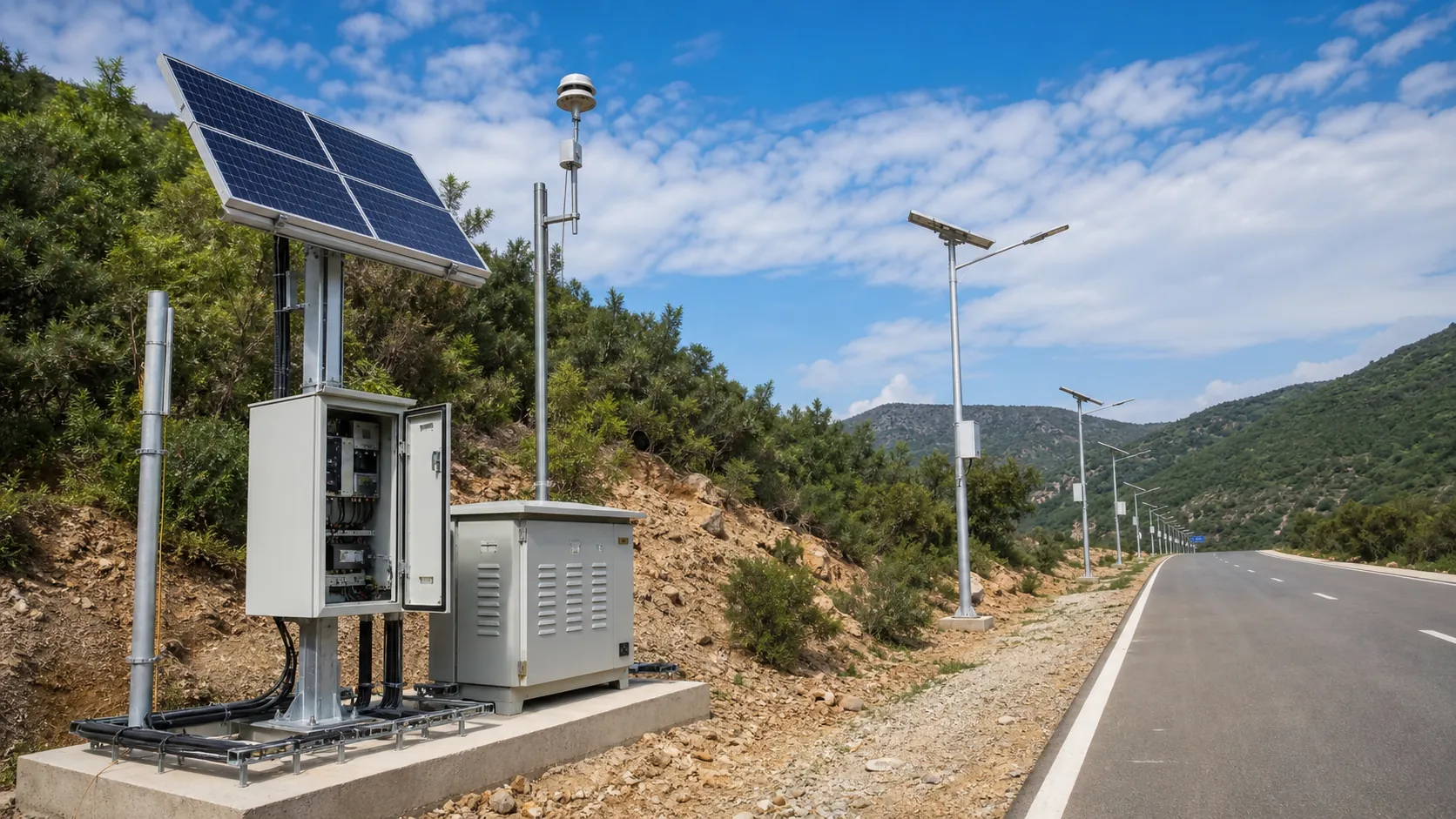
Solar Off-Grid IoT
Design solar-powered outdoor IoT systems with panels, batteries, controllers, low-power devices, gateways and remote power monitoring.
Power and Connectivity
How to choose power, battery, solar, NB-IoT, LTE, LoRaWAN, gateways and monitoring strategy for outdoor IoT infrastructure.
Frequently Asked Questions
How far away can the RC-WFD-900 detect a wildfire?
By day it can see smoke plumes up to roughly 20 km with the visible camera; at night the thermal core detects open flame and hotspots up to about 8 km. Actual range depends on terrain, tower height, atmospheric clarity, and the chosen lens/sensor.
Does it work at night and in poor visibility?
Yes. A daytime smoke-plume model runs on the visible stream and a thermal hotspot model runs on the infrared stream, so detection continues after dark. An optional NIR laser illuminator helps in low light, and the thermal core sees heat through light haze and darkness.
How does the system pinpoint a fire's location?
Each tower reports a precise bearing to the smoke. When two or more towers see the same fire, the cloud platform triangulates GPS coordinates and overlays them on terrain and fuel maps. A single tower gives a line-of-sight sector until a second confirms it.
How does it avoid false alarms?
Edge AI filters obvious non-events on the tower, the cloud correlates and scores candidates, and a human-in-the-loop confirmation step lets operators verify or dismiss before any dispatch alert is sent — filtering dust, cloud shadow, and industrial plumes.
Does it need grid power or internet at the site?
No. It is built off-grid first, running on solar (or wind-solar hybrid) with a LiFePO4 battery giving 5–10 days of no-sun autonomy. Backhaul can be 4G/5G, tower-to-tower microwave, satellite, or a low-power LoRa alert channel where video links are unavailable.
How many towers do I need to cover my area?
It depends on terrain, canopy, and required detection range. REDCOAST.LTD provides a line-of-sight coverage study from your maps and recommends tower count and placement so that critical areas are seen by at least two towers for GPS triangulation.
Can it integrate with our dispatch and existing camera systems?
Yes. Video is available over ONVIF/RTSP, telemetry over MQTT/HTTPS, and alerts in CAP format for public-warning and dispatch systems. The platform can also ingest satellite fire feeds and feed events into an existing command or VMS environment.
What climates and conditions can it operate in?
It is rated IP66/IP67 and operates from -40 °C to +70 °C, survives wind gusts up to 60 m/s, and includes a heater option to keep optics clear in freezing fog — suitable for alpine, temperate, tropical, and desert-margin fire environments.