Overview
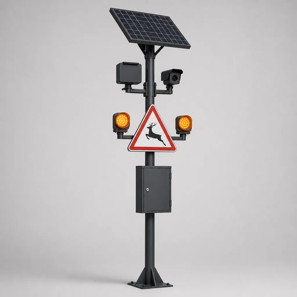
The RC-WDS-400 is an off-grid, solar-powered animal detection and driver warning system engineered for rural and remote highway segments where large animals — camels, deer, elk, moose, wild boar, kangaroos, horses and free-ranging livestock — regularly cross the carriageway. Animal–vehicle collisions are a leading cause of severe rural road accidents worldwide; a single collision with a 500–700 kg animal at highway speed is frequently fatal for both driver and animal. Static warning signs are largely ignored because they warn constantly, whether an animal is present or not. The RC-WDS-400 solves this by warning drivers only when an animal is actually detected in or approaching the roadway: a chain of radar/thermal detection nodes monitors the roadside corridor 24/7, and when a large animal is confirmed, amber LED warning beacons and full-matrix signs upstream of the crossing zone activate immediately, prompting drivers to slow down before they reach the hazard. Because these road segments are typically far from any grid connection, every node is fully solar-powered with multi-day battery autonomy. REDCOAST.LTD delivers the complete system — detection nodes, warning signs, wireless networking, cloud platform and mobile app — as one integrated, project-customized solution built on its own hardware designs, including in-house radar signal-conditioning, LED beacon driver and MPPT power-management PCBs.
Key Features
- Detect-then-warn logic: warning signs flash only when an animal is actually present, preserving driver trust and achieving measurable speed reductions that static signage cannot
- Dual-technology detection: 24 GHz / 77 GHz FMCW radar for all-weather, day/night detection at up to 250 m per node, with optional thermal imaging camera (384×288 or 640×512) for AI species classification and visual verification
- Edge AI classification on a low-power inference board distinguishes large animals from vehicles, pedestrians and windblown vegetation, keeping false alarm rates low
- Networked corridor coverage: detection nodes and warning signs form a LoRa mesh along the road; one detection activates all relevant upstream signs in both directions within 1–2 seconds
- Fully off-grid: MPPT solar charging with LiFePO4 battery banks sized for 5–7 days of autonomy under low-sun conditions; optional wind–solar hybrid for high-latitude winter sites
- MUTCD / EN 12352 compliant warning hardware: W11-series animal-crossing sign faces with dual synchronized amber flashers, or full-matrix LED signs displaying speed advisories and text
- Event logging and analytics: every detection is timestamped and geolocated, building a crossing-hotspot heat map that road authorities can use for fencing, wildlife-passage and mitigation planning
- Remote management: 4G/LTE backhaul gateway with cloud platform and mobile app for live status, battery health, detection statistics and over-the-air configuration
- Harsh-environment design: IP66 enclosures, -40 to +65 °C operation, desert sand/dust and coastal salt-fog tolerant, wind-rated poles and mounts
- In-house hardware: radar front-end signal conditioning, beacon constant-current LED drivers, MPPT charge controller and low-power system-management PCBs are all designed by REDCOAST.LTD and can be adapted per project
Technical Architecture
A deployed RC-WDS-400 corridor consists of three hardware layers. The first layer is the detection node: a pole-mounted unit combining an FMCW radar (24 GHz standard, 77 GHz high-resolution option) that continuously scans a 100–250 m roadside sector, and an optional uncooled thermal camera that verifies and classifies targets. Radar returns pass through REDCOAST.LTD's own signal-conditioning PCB, which filters clutter from rain, moving vegetation and passing vehicles before target data reaches the edge AI board. The AI model — trained on large-animal signatures including camel, deer, elk, boar and cattle — evaluates target size, speed, trajectory and (when the thermal option is fitted) visual class, and only raises an alarm for a confirmed large animal moving within the configured detection zone. Typical detection-to-alarm latency is under 2 seconds.
The second layer is the warning layer: solar-powered LED warning stations installed 200–500 m upstream of the protected zone in each direction. Each station carries a retroreflective animal-crossing sign face with two synchronized high-intensity amber beacons driven by REDCOAST.LTD's constant-current driver PCB (with automatic day/night dimming), or optionally a full-matrix amber LED sign that can display advisory speeds and messages such as "ANIMALS ON ROAD". Activation commands travel over the corridor's LoRa mesh, so a detection at any node lights every relevant sign; beacons flash for a configurable hold time (typically 60–300 s) and re-arm automatically.
The third layer is the gateway and platform layer: one corridor gateway aggregates node status and detection events and backhauls them over 4G/LTE (or satellite IoT where cellular is absent) to the REDCOAST.LTD cloud platform. Operators see a live corridor map, per-node battery and solar telemetry, detection history and false-alarm statistics, and can adjust zones, sensitivities and flash times remotely. All alarm logic runs at the edge — the corridor keeps protecting drivers even with the backhaul down.
Connectivity & Power
Connectivity. Inter-node communication uses long-range LoRa mesh (2–5 km line-of-sight between stations), which suits linear highway corridors with no cellular planning burden. The corridor gateway uplinks via 4G/LTE as standard; NB-IoT is available for telemetry-only deployments, and satellite IoT (e.g., for desert or mountain segments with no cellular coverage at all) is a project option. All protocols are open and documented, and detections can be pushed to third-party traffic-management centers via MQTT or REST API.
Power. These systems are specified for remote roads where grid connection is impractical, so every station is off-grid by design: a 100–200 W monocrystalline solar panel per station, REDCOAST.LTD's own MPPT charge-control and power-management PCB, and a 12/24 V LiFePO4 battery bank (typically 50–150 Ah) sized for 5–7 days of autonomy. Load management in firmware throttles non-essential functions (e.g., thermal video upload) under prolonged low sun while always preserving detection and warning. For high-latitude sites with weak winter sun, a wind–solar hybrid configuration with a 300–600 W micro wind turbine is available. Where a site happens to have mains power (e.g., near a toll plaza), an AC-input variant can be supplied — power is a configuration, not a limitation.
Protection & Reliability
All electronics are housed in IP66 powder-coated enclosures with stainless hardware; poles and brackets are hot-dip galvanized and finished with smooth powder-coat or fluorocarbon paint for long-term corrosion protection in desert, coastal and alpine climates. Operating range is -40 to +65 °C with conformal-coated PCBs against condensation and dust. Radar detection is inherently robust in fog, heavy rain, snow and total darkness — precisely the conditions in which animal collisions peak. LED beacons are rated L10 ≥ 50,000 h; LiFePO4 batteries deliver ≥ 2,000 cycles at 80 % DoD and are housed in ventilated, lockable battery compartments. Surge protection on solar, radio and I/O lines, plus a watchdog-supervised controller with automatic recovery, keep field visits rare. Standard warranty is 2 years, extendable to 5 years per project.
Application Scenarios
- Desert highways with camel crossings: on fenced or open desert routes, free-roaming camels cause severe nighttime collisions; RC-WDS-400 detects camels approaching the carriageway and activates upstream warnings, protecting drivers on roads where lighting and cellular coverage are sparse.
- Forest and mountain roads with deer, elk or moose: seasonal migration corridors see collision spikes at dawn and dusk; detect-then-warn signing has been shown to reduce approach speeds meaningfully, cutting collision severity.
- Wildlife-crossing and fence-gap mitigation: at ends of exclusion fencing or at designated at-grade wildlife crossings, the system concentrates protection exactly where animals funnel onto the road.
- Ranch and open-range livestock zones: where cattle, horses or sheep graze unfenced along rural roads, the system warns of stray livestock and logs incursion patterns for local authorities and ranchers.
- National-park and reserve roads: park authorities can protect both visitors and protected species, with detection analytics doubling as a wildlife-activity dataset for conservation teams.
- Accident black-spot retrofit: road authorities can deploy corridors of 2–10 stations at documented animal-collision black spots as a faster, far cheaper alternative to overpasses or continuous fencing.
Case-style Examples
Desert highway camel-warning corridor. A road authority needed to reduce nighttime camel collisions on a 12 km unlit desert segment with no grid power. The deployment used eight radar detection nodes with thermal verification at known crossing points, plus six full-matrix warning signs displaying an advisory speed when camels were detected. Each station ran on a 160 W panel with 7-day battery autonomy; satellite IoT provided backhaul on the segment without cellular service. Detection logs identified two dominant crossing funnels, letting the authority target future fencing precisely.
Mountain-road elk migration season. A forest road with a documented spring/autumn elk migration received a four-node corridor with dual-beacon W11-style signs. Radar-only detection was chosen for budget reasons, with LoRa mesh linking both approaches. The system operates through heavy snow and fog, and seasonal detection statistics are exported to the regional wildlife agency.
Open-range livestock protection near a rural junction. A local government protected a junction crossed daily by free-grazing cattle with two combined detection/warning stations. Because the site had weak winter sun, wind–solar hybrid power was specified. The app alerts the municipal patrol when animals remain on the road longer than a set threshold, so crews can respond before an accident occurs.
Customization & Selection Guide
- Sensor suite: radar-only nodes are the most economical and fully weatherproof; add thermal AI cameras where species classification, visual verification or very low false-alarm rates are required; visible-light cameras can be added for daytime documentation.
- Warning hardware: dual amber flashers on static sign faces suit most rural roads; choose full-matrix LED signs where variable advisory speeds or multilingual text are needed.
- Corridor length and node spacing: nodes are typically spaced 200–400 m; short black spots need 2–4 stations, long migration corridors scale to dozens — the LoRa mesh and platform scale accordingly.
- Power sizing: panel and battery capacity are engineered from site solar-irradiance data and the selected sensor load; specify wind–solar hybrid for high latitudes and the AC variant only where mains power already exists.
- Backhaul: 4G/LTE where cellular exists; satellite IoT for fully remote segments; telemetry-only NB-IoT for minimal-data deployments.
Deployment & After-sales
Stations mount on 3–6 m poles with ground-screw, concrete or ballast foundations; each station is pre-wired and factory-tested, so field installation is typically under half a day per station with no trenching or cabling between stations. REDCOAST.LTD supplies corridor design support (node placement from crossing-hotspot data, radar coverage modeling, solar sizing), remote commissioning, operator training and full documentation. Typical lead time is project-dependent and confirmed at order; spare-part kits, firmware updates and remote diagnostics are provided throughout the support term, with 2-year standard warranty extendable to 5 years.
Standards & Compliance
Designed toward CE and RoHS; radar modules operate in the 24 GHz ISM / 76–81 GHz automotive bands under ETSI EN 300 440 / EN 301 091 (regional radio approvals arranged per project); LED flashing beacons designed toward EN 12352 optical classes and MUTCD Chapter 2C/4L practice for warning beacons; enclosure ingress protection IP66 per IEC 60529; EMC per EN 61000 series; LiFePO4 packs per UN 38.3 transport certification; structural mounts designed for site wind loads per local codes.
Why REDCOAST.LTD
REDCOAST.LTD is an end-to-end smart-infrastructure solution provider: detection hardware, warning signs, wireless networking, cloud platform and mobile app come from one team and are engineered to work together. What sets the company apart from integrators is that the core electronics are its own designs — the radar signal-conditioning front end, edge AI carrier board, LED beacon constant-current drivers and MPPT power-management PCBs are all developed in-house and can be re-spun for project-specific needs, whether that means a different radar band, a custom sign face, an unusual battery chemistry or integration with an existing traffic-management platform. That vertical control means realistic delivery commitments, deep customization and long-term firmware support instead of a box of third-party parts.
Ready to protect a road segment where animals and traffic meet? Contact REDCOAST.LTD with your site details — corridor length, species, climate and sun conditions — and we will engineer a detection and warning corridor tailored to your project.
Specifications
Detection & Sensing
- Radar Type
- 24 GHz FMCW (77 GHz option)
- Radar Detection Range
- 100-250 per node m
- Detection Zone Width
- up to 30 m
- Thermal Camera (optional)
- 384x288 / 640x512, 8-14 um
- Target Classes
- camel, deer/elk/moose, boar, livestock, horse
- Detection-to-Alarm Latency
- <2 s
- Minimum Detected Target
- approx. 0.5 m shoulder height
Warning & Signage
- Beacon Type
- dual synchronized amber LED, 300 mm
- Beacon Compliance
- EN 12352 / MUTCD flashing beacon practice
- Full-Matrix Sign (optional)
- P10-P16 amber, 64x32 to 96x48 pixels
- Beacon Visibility
- >=1,000 daytime m
- Auto Dimming
- 100-10 (day/night) %
- Activation Hold Time
- 60-300 (configurable) s
Edge AI & Data
- Edge AI Performance
- up to 6 TOPS
- False-Alarm Filtering
- size/speed/trajectory + AI class fusion
- Event Logging
- timestamp, GPS position, class, direction
- Local Storage
- 32-256 GB
- Platform Integration
- MQTT, REST API, cloud dashboard + app
Connectivity
- Inter-node Mesh
- LoRa 868/915 MHz, 2-5 km LOS
- Backhaul
- 4G/LTE Cat 4 (NB-IoT / satellite IoT options)
- Positioning
- GPS/GNSS per station
- Remote Management
- OTA config & firmware, watchdog auto-recovery
Solar Power System (off-grid)
- Solar Panel
- 100-200 monocrystalline W
- Charge Controller
- MPPT, in-house PCB, eff. >=97 %
- Battery
- LiFePO4 12/24 V, 50-150 Ah
- Autonomy
- 5-7 days
- Avg. Node Consumption
- 6-18 (config-dependent) W
- Hybrid Option
- 300-600 W micro wind turbine
Mechanical & Environmental
- IP Rating
- IP66 (electronics enclosures)
- Operating Temperature
- -40 to +65 °C
- Pole Height
- 3-6 m
- Wind Rating
- up to 160 km/h
- Surface Finish
- hot-dip galvanized + powder-coat / fluorocarbon paint
- Surge Protection
- solar / radio / I/O lines, Type 2
Capabilities — configurable per project
Specifications are tailored to each project — the options below show what we can support.
Sensor Suite
- Radar only
- Radar + thermal AI camera
- Radar + thermal + visible camera
Warning Hardware
- Dual amber flashers on static sign
- Full-matrix amber LED sign
- Flashers + advisory speed display
Power
- Solar off-grid (standard)
- Wind-solar hybrid
- AC mains variant (where grid exists)
Backhaul
- 4G/LTE
- NB-IoT
- Satellite IoT
Deployment Environment
- Desert
- Alpine/high-latitude
- Coastal
- Forest/mountain roads
Related solution guidance
Traffic Safety Checklist
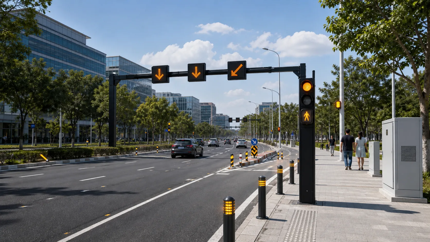
Deployment checklist for connected traffic warning signs, beacons, road guidance devices, power, visibility, monitoring and acceptance tests.
Traffic Safety
Plan connected traffic safety systems with warning beacons, LED signs, road guidance devices, sensing, control cabinets and monitoring software.
Ports and Logistics
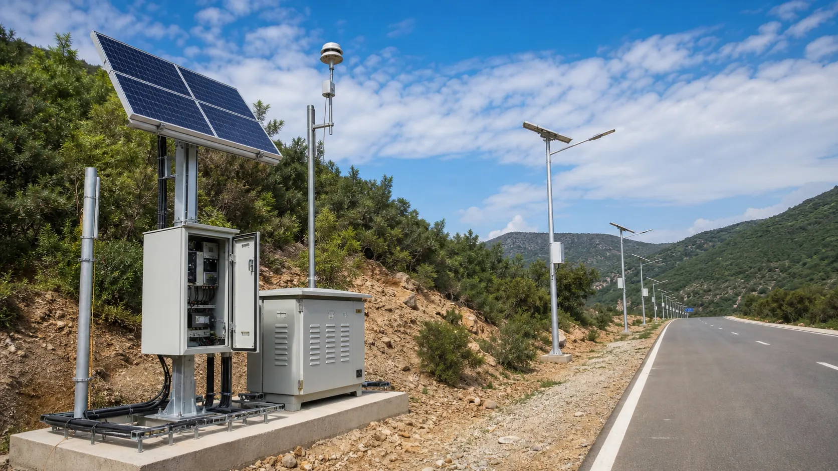
Outdoor IoT infrastructure for ports, yards and logistics areas: lighting, guidance, safety, solar power, monitoring and maintenance visibility.
Frequently Asked Questions
How does an animal detection and driver warning system work?
Roadside detection nodes use FMCW radar (optionally verified by a thermal AI camera) to monitor the corridor beside and on the road. When a large animal such as a camel, deer or cow is confirmed within the detection zone, the system activates amber LED warning beacons or full-matrix signs placed 200-500 m upstream in both directions within about 2 seconds, so drivers slow down only when a real hazard is present.
Why is detect-then-warn signage more effective than static animal crossing signs?
Static signs warn constantly regardless of whether an animal is present, so drivers quickly learn to ignore them. Activated warning systems flash only during a confirmed detection; field deployments of radar-based systems have recorded meaningful approach-speed reductions (on the order of 15%) when warnings are active, which directly lowers collision probability and severity.
Does the system work at night and in fog, rain or snow?
Yes. Radar detection is independent of light and weather, operating in complete darkness, fog, heavy rain and snowfall — exactly the conditions when animal collisions peak. The optional thermal camera also works in total darkness, adding species classification and visual verification without needing any illumination.
Can it run without any grid power or cellular coverage?
Yes. Each station is fully off-grid, powered by a 100-200 W solar panel with an MPPT charge controller and a LiFePO4 battery sized for 5-7 days of autonomy; a wind-solar hybrid option covers weak-sun climates. Stations communicate over a LoRa mesh, and where there is no cellular network at all, the corridor gateway can use satellite IoT for backhaul. All warning logic runs locally, so the system protects drivers even offline.
Which animals can the RC-WDS-400 detect?
It targets large animals whose collisions cause serious accidents: camels, deer, elk, moose, wild boar, kangaroos, horses, cattle and other livestock. Detection thresholds are configurable by target size, speed and trajectory, and the optional thermal AI adds species-level classification while filtering out vehicles, pedestrians and vegetation movement.
How many detection stations does a road segment need?
Detection nodes are typically spaced 200-400 m apart along the protected corridor, with warning signs placed 200-500 m upstream of each end in both directions. A localized black spot usually needs 2-4 stations, while long migration corridors scale to dozens of nodes on the same LoRa mesh and management platform. REDCOAST.LTD provides corridor design based on your collision or crossing-hotspot data.
Can the system integrate with an existing traffic management center?
Yes. Detections and station health data are available via MQTT and REST APIs, so events can be pushed to existing ATMS/TMC software, and the cloud platform can coexist with or feed your current systems. Custom protocol integration is available because REDCOAST.LTD develops the gateway hardware and firmware in-house.
What maintenance does a solar animal detection system require?
Very little. LiFePO4 batteries last 2,000+ cycles (typically 8-10 years), LED beacons are rated 50,000+ hours, and all stations report battery, solar and fault telemetry remotely with over-the-air updates. Routine work is generally limited to occasional panel cleaning in dusty environments and a periodic visual inspection; the standard warranty is 2 years, extendable to 5.